Great Smoky Mountains National Park: Hit the Trails
We may earn money or products from the companies mentioned in this post.
“In such places standing alone on the mountain-top it is easy to realize that whatever special nests we make – leaves and moss like the marmots and birds, or tents or piled stone – we all dwell in a house of one room – the world with the firmament for its roof…”
– John Muir
Half a million acres of wilderness in the east
Only 14 of the 63 U.S. National Parks exist in the eastern half of the United States, where 80% of the population lives. The other 49 are spread out among the vast western landscapes, the island chains, and the last great frontier – Alaska. It’s no wonder then that the only National Park without an entrance fee is the most visited with just over 12 million visitors per year. Great Smoky Mountains National Park is a busy place at times, but there are still many opportunities to find solitude…if you’re willing to walk.
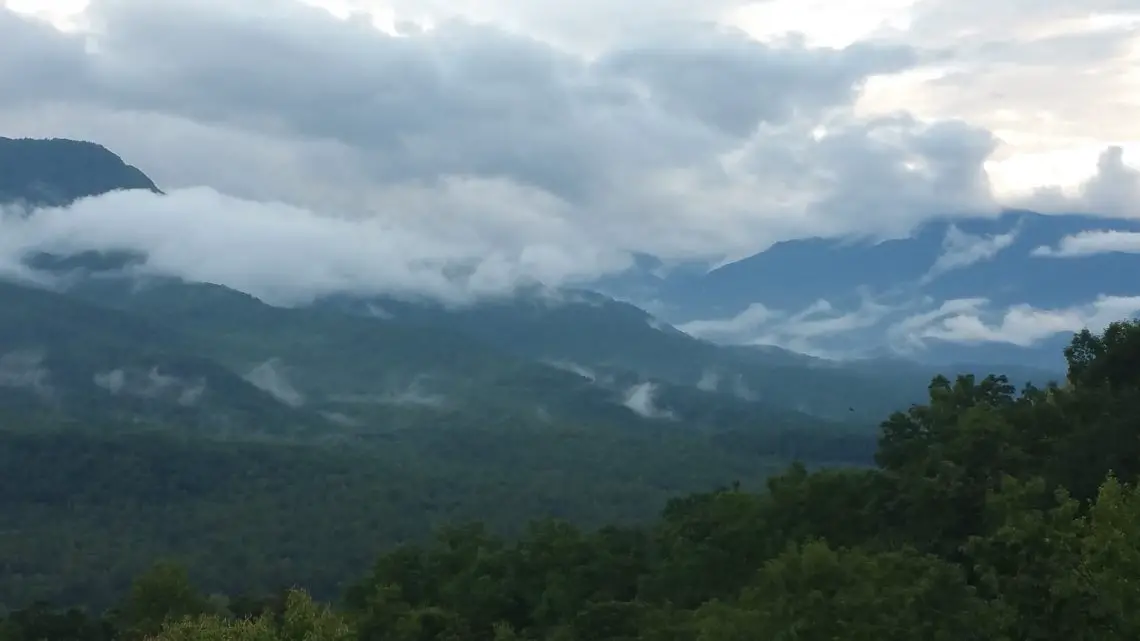
The Great Smoky Mountains were named for the blue colored haze that hovers among the mountain tops during certain weather patterns. The Cherokee called this place “Shaconage”, which translates to, “place of the blue smoke”. With over 90 inches of rain per year, it’s a temperate rainforest. At any time, while out hiking and exploring, a storm could brew up and leave you soaked to the bone. I speak from experience about this. The Great Smoky Mountains are a UNESCO World Heritage Reserve because of the vast variety of plant and animal species. In fact, more species of salamanders exist within the national park than any other place in the world.

It is a spectacular landscape engorged with wildlife, endless vistas and countless waterfalls. Driving one of the parks 2 main roads will reward you with beautiful scenery and ample opportunities to get out and stretch your legs, but the Smokies I know can only be fully experienced on the 800+ miles of hiking trails.
I haven’t hiked all 800 miles of trails…not even close, however, I have hiked several of the trails many times. I would say that I’ve hiked somewhere around 400 miles total in the Smokies over 4 decades. So, I certainly know what I’m talking about and can offer up a list of my top 5 favorite hikes. Please remember to hike responsibly – leave no trace, hike with a hiking buddy, bring water, snacks, first aid kit, emergency whistle and quality footwear. Oh yeah, don’t forget a poncho, because Great Smoky Mountains weather in the spring and summer months is notoriously unpredictable.
Here are my 5 favorite hikes in Great Smoky Mountains National Park:
1 – Alum Cave Bluffs
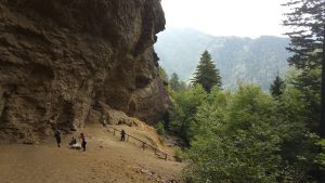 I have hiked this trail twice and it has become one of my favorites. The trail starts out crossing a footbridge over Walker Camp Prong and Alum Cave Creek, which you’ll follow for a while as you ascend the valley toward Peregrine Peak. About a mile into the trail, you’ll ascend a staircase through an arch rock, one of the highlights of the trail. At about 2 miles in, you’ll reach the portion of the trail that is exposed to spectacular views of the surrounding mountains. Finally, at just under 2.5 miles in, you’ll reach Alum Cave Bluff, a massive overhanging rock that shelters the sandy, rocky terrain below.
Despite the high levels of moisture surrounding this area, Alum Cave always stays very dry and dusty. If you have prepared for it ahead of time, continue up the trail for another 2.5 miles to the top of Mt. LeConte (elevation 6,593’) where a rustic lodge awaits the weary traveler. Be sure to start out early as this is a very popular trail and parking can be hard to find.
For directions to the trailhead, follow this link.
2 – Ramsey Cascades
If you’re a waterfall lover like me, you’ll love Ramsey Cascades. Counting the main plunge and the smaller cascades, 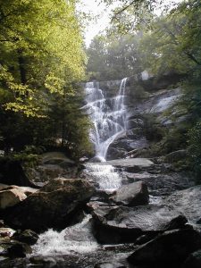 Ramsey Prong drops 100 feet in total, but prepare yourself for a challenging trail that gains over 2,000’ in elevation over 4 miles. The Ramsey Cascades trailhead starts in the Greenbrier section of Great Smoky Mountains National Park and starts out easy enough, following an old gravel road for the first half mile, but it soon narrows and steepens as it snakes through patches of rhododendron. You’ll follow Ramsey Prong almost the entire way, crossing over on footbridges twice. The trail itself is a pleasure because of the constant sound of the water from the sluices and cascades on the creek.
Prior to this being national park land, this was a heavily logged area just below Mt. Guyot, but the last 2 miles of the hike feature much old-growth forest, including 3 massive tulip trees (yellow poplar) that require 3 adults at full stretch to reach around the diameter of the trunk. At 3.5 miles, prepare to climb on and around boulders as you make the final ascent to the falls. The sound of the falls in the distance and the sight of a wall of water through the trees will give you a boost of adrenaline to carry you the rest of the way. Take some time to take it all in, rest, recover and refuel. You’ll need it for the returning 4 miles!
For directions to the trailhead, follow this link.
3 – Charlie’s Bunion
Have you always wanted to hike parts of the world famous Appalachian Trail (AT) but weren’t sure where to start? This is an opportunity to hike 4 miles of it straddling the Tennessee and North Carolina border, ending in a truly magical destination. The trailhead starts at Newfound Gap, a popular stop and overlook where FDR christened the park in 1940. This is your chance to use 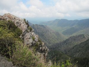 the restroom and gear up for your hike.
Over the course of the 4 miles, you’ll pass by several intersecting trails and some beautiful mountain views to the north and south. The elevation gain is approximately 1,600’ over the 4 miles, so not quite as strenuous or rugged as Ramsey Cascades, but you’ll still want to bring plenty of water and protein packed snacks with you. Right around 4 miles is a short side trail that branches off to the left and leads you to Charlie’s Bunion. This rock outcropping provides some of the best mountain views in all of the Great Smoky Mountains National Park, but beware, if you’re afraid of heights, don’t climb out on the rock outcropping. The drop from Charlie’s Bunion is around 1,000 feet, so be very careful.
If you’re feeling ambitious, take a side trek on the Boulevard Trail at 2.7 miles in. Not far from the junction with the AT is an unmarked trail up to “The Jumpoff”, another rock outcropping with spectacular views. This would add another mile to your roundtrip hike, but makes a great spot for a picnic.
To view directions to Newfound Gap, follow this link.
4 – Road Prong Trail
This trail is special to me, not because of the destination, but because of the trail itself. I’ve hiked this trail a couple of times and it is so much fun, I’d love to go back again. Be forewarned that this is not for the novice hiker. You also may want to bring some waterproof boot gaiters to help keep some water out of your hiking boots.
There are three ways to hike this:
1) Drive a vehicle up to the trailhead parking area on Clingmans Dome Rd, then come back to the Chimney Tops trailhead and hike up from the Chimney Tops Trail.
2) Leave a vehicle at the Chimney Tops trailhead and then drive up to the parking area on Clingmans Dome Rd and hike down to the Chimney Tops Trail.
3) Hike from the trailhead on Clingmans Dome Rd down to a point and then return the way you came.
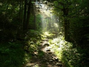 I’ve personally only done the latter, so I’ll provide a description based on that route. This trail starts on the side of Clingmans Dome Rd not far from Newfound Gap. The trailhead intersects the AT as it travels down from Clingman’s Dome (highest point in Great Smoky Mountains National Park) to Newfound Gap and on to Charlie’s Bunion and beyond. You’ll start with a fairly steep descent into a deep pine forest.
You may be able to catch some beautiful sun rays filtering through the trees if it’s the right time of day.
As you continue on, you’ll notice that you’ll lose track of the trail as you approach Road Prong. That’s because the creek becomes the trail! Hike across the creek and onto a small patch of land between curves in the creek. You’ll weave in and out of the creek over and over 10 to 12 times before finally making it to dry land. Be very careful of slippery rocks and if you have a walking stick or trekking poles, use them to stabilize yourself.
At about a mile and half in, you’ll notice some moss and lichen covered boulders and trees on the right. Continue on to about the 2 mile mark and a small, but pretty waterfall will be on the left. This is a great spot to picnic and rest, or just jump in and cool off. There’s another cascade just a tenth of a mile down the trail and it’s worth the effort. Drink plenty of water, because you’ll need to be hydrated for the trip back up hill to the top. It’s an unforgettable trail that you’ll probably wish you’d skipped, but also be glad that you didn’t miss it!
For directions there, follow this link.
5 – Baskins Creek Falls
I considered adding Grotto Falls to the list because Grotto Falls, if timed right, would provide an unforgettable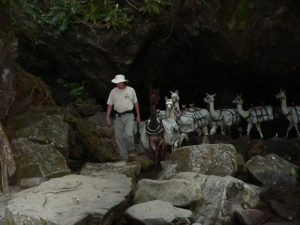 experience with the pack of llamas taking supplies up to Mt. LeConte by passing behind the waterfall. I’ve been fortunate enough to capture this on camera, but timing this just right can be pretty difficult, especially when there are 60 other people up there with you.
Instead, I picked another hike, which I’ve completed 5 times, for a very different reason.
While most of the tourist types are hiking Rainbow Falls (or attempting to) and Grotto Falls on the Roaring Fork Motor Nature Trail, you can expect to have the silence and seclusion you’ve been longing for on the Baskins Creek Falls Trail.
There are two trailheads to choose from…an upper and a lower. I recommend parking at the lower trailhead just before the road turns a sharp right and dives down over a bridge that crosses Roaring Fork. Pull into one of the parking spots straight ahead (if you can), or cross over the bridge and park in a spot by the open field with all the old cabins.
Just a hundred yards or so past the trailhead, you’ll pass by an old cemetery that has been fenced off. Many of the headstones are slabs of slate or are just large rocks. Others are carved headstones. As you pass by, remember those who have gone before – and remember that I once stripped naked to get out of my soaking wet clothes right there after a freak thunderstorm poured torrents of rain down on 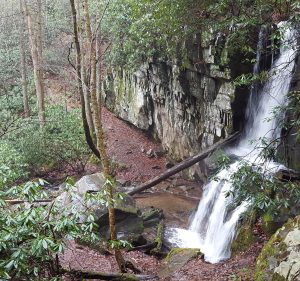 our heads. Such fond memories…now, where was I? Oh yes, continue on for awhile until you hit a ridgeline surrounded by mountain laurel on both sides.
Not too far from the mountain laurel patches, you’ll start descending into the valley at this point, getting closer and closer to the creek. As you reach the bottom of the valley, be careful of the mud holes on the trail as they can be slippery. At about a mile into the hike, you’ll hit an intersection with a side trail. Going straight would take you up to the first trailhead and turning right will take you to the falls. Follow this path for about .3 miles to a steep descent into a little cove where beautiful Baskins Creek spills over a 2 tiered ledge. This is a fantastic spot to take pictures, rock hop, explore, and picnic. You may very well have this place to yourself, so enjoy it!
Return the way you came, but prepare to climb back up 950 feet of elevation.
For more information, visit this site.
When to go
There really is not a bad time to go to Great Smoky Mountains National Park, however, keep in mind that the park rangers may need to close certain roads, such as Newfound Gap Road, in the winter due to snow and ice. Keep your eye on the weather in the Smoky Mountains prior to planning out a trip. One thing is certain; if you are fortunate with the weather, you’ll have the park practically to yourself.
Summer is always packed, and if you’re staying in Gatlinburg, plan on having to fight crowds in town, at the gas stations, at the grocery stores, and even in the national park. My advice is to look ahead at the Gatlinburg event calendar and avoid any holiday weekends or the week of the Gatlinburg Craftsmen’s Fair.
Two excellent times to go are from late March to early May and then September (after Labor Day weekend) to early October. In mid to late October, Gatlinburg will become very crowded with people wanting to see the leaves changing. So, not only will the crowds be lower during these date ranges, but the cost of hotel rooms and cabins will also be lower.
Just get out there
If the beach is more your style, then by all means, get out there but if the mountains are your place of refuge like me, make sure you do more than sit in the car. These hikes have provided some of my greatest memories over the 40 years I’ve visited the Great Smoky Mountains National Park. Regardless of if you choose a high traffic hike like Laurel Falls or the road less traveled like Baskins Creek Falls, just get out there, take some risks and experience it all for yourself.
Michael Hogue is a husband, father, and digital marketer. He’s the founder of Firefall Digital Marketing and Hogue Coaching LLC. You can follow him on Facebook.


